Open: Wed 1:00 PM - 5:00 PM
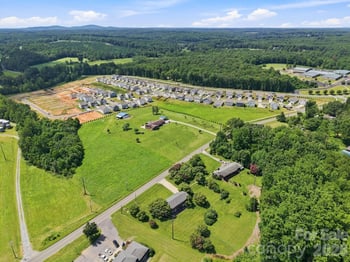
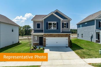
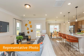




The Town of Catawba is small enough that you can walk the whole of it, and it has kept more of itself than most towns that size manage. It grew up around a railroad siding, it still has its 1890s storefronts, and it sits between two completely different bodies of water with the interstate two and a half miles up the road. Here is what is actually here, including the parts that require a short drive.
The depot went up at a siding on the Western North Carolina Railroad in the late 1850s, on the line being pushed through from Salisbury toward Asheville. The village organised itself as Catawba Station in 1872, with corporate limits drawn as a half-mile circle around the depot, and incorporated as the Town of Catawba in 1893. For years it was a market centre for locally grown tobacco and flour, and a distribution point for railroad crossties.
The rail cut still forms the northern edge of the old town, with the tracks running about thirty feet below the banks on either side. The depot itself is long gone, but the bridge that carries Main Street over the line is not: it was built in 1928 by the state highway commission and still has its four concrete lamp posts with octagonal amber-glass lamps, matching the ones on the county courthouse of the year before.
The town was also the base for building Lookout Shoals Dam in 1914, which is the first of the two lakes. Electric lights arrived in 1925 and paved streets and sidewalks the following few years.
Catawba's historic district covers about seventy acres with forty-eight contributing buildings, listed on the National Register in 1986 as a remarkably intact example of a small railroad and commercial centre of the late nineteenth and early twentieth centuries. The street plan is a true quadrant: Main Street runs north to south, Central Avenue east to west, and the avenues and streets sort themselves out from there.
What is unusual is that the district is not purely commercial. It takes in farmhouses and tracts of farmland with their outbuildings alongside the village houses and the stores, which the nomination describes as a now rare glimpse of a small rural community of that era. One farm in it keeps the best collection of outbuildings in the district: barns, granaries, a smokehouse, and a well house. Another farmhouse sits a few hundred feet back from Central Avenue in open fields, inside a ring of oaks planted in 1905.
Named buildings worth looking up as you walk: the Sherrill Tobacco Company building of the 1890s, whose plug tobacco went out under the splendid brand names "Ten Cent Cotton" and "16 to 1"; the Catawba Drug Company; Long and Company Store; and the Catawba Garage of the late twenties. The water tower southeast of Town Hall went up in 1936, built by the Chicago Iron and Bridge Works, with a little brick pumphouse beside it.
The oldest brick building in town, a house from about 1873 with a two-tier porch, an exterior stairway, and six front doors, is now the local historical association's museum, with five rooms of town history. It opens by appointment rather than on a schedule, so ring ahead. The association also publishes a walking tour of the district, which is the right way to see all of the above.
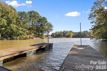
This trips people up, so it is worth being precise. Lookout Shoals Lake lies upstream to the northwest: 1,305 acres with around twenty-nine miles of shoreline, formed in 1915, one of the smallest reservoirs on the Catawba chain, with largemouth bass, crappie, sunfish, and catfish in it. The public boat ramp on Lookout Dam Road is about six miles from the middle of town.
Lake Norman is the other direction. Its headwaters begin immediately below Lookout Shoals Dam, so the Lake Norman reach runs east and southeast of Catawba, and the Long Island public access on Long Island Road, about seven miles out, launches onto it. Between the two, below Oxford Dam, there is a free-flowing stretch of the actual river.
That middle stretch gives you the best paddle around here. Put in at Riverbend Park, about twelve miles away, and the nearest public take-out is ten and a half river miles downstream at the Lookout Shoals access, which makes for a proper day rather than an hour of pottering. Riverbend itself runs to 690 acres with a mile and a quarter of river shoreline and getting on for twenty miles of trail.
In town, David A. Hunsucker Memorial Park on Second Street Northeast is the local park, named for a former town clerk and treasurer, with a walking trail, playground, picnic shelters, a volleyball court, and horseshoe pits. It has no boat ramp, and there is no greenway network in town, so set expectations accordingly. The larger county parks are a drive: Mountain Creek Park on Lake Norman is about thirteen miles south with some nineteen miles of trail and a paddle launch, and Bakers Mountain over toward Hickory has the county's highest point and its largest mature forest.
Murray's Mill is three miles from town and it is the real thing: a working roller mill built in 1913 with its twenty-eight-foot waterwheel intact, the Murray and Minges general store from the 1890s, an 1880s wheathouse now used as an exhibit gallery, and the miller's house furnished to period. Three generations of Murrays ran it, from the 1880s until it closed in 1967, and restoration began a decade or so later. The grounds carry more than three miles of trail through ponds, woods, fields, and creek bottom, and leashed dogs are welcome. The Harvest Folk Festival there in late September has been running for over forty years.
Four miles the other way, at Claremont, the Bunker Hill Covered Bridge crosses Lyle Creek on a bypassed stretch of the old Island Ford Road. It was built in 1895, it is a Haupt truss, possibly the last wooden one left in the country, and the engineers' institute designated it a national historic civil engineering landmark.
Other mills are under the water. Long Island Mill, built in the early 1850s where an island split the river, was still running as a yarn mill when it closed in October 1959 because Lake Norman was coming, and the mill village went under with it. The nearby Monbo mill went the same way. So the Long Island boat ramp launches onto the lake that drowned the village the road is named for.
For food grown here rather than milled here, two farms carry a Catawba address in the county's own food guide. One does u-pick strawberries in spring, blackberries in summer, and pumpkins in autumn, with a farm market alongside. The other, up on Hopewell Church Road, grows rabbiteye and southern highbush blueberries for picking from midsummer and raises shiitake, oyster, and lion's mane mushrooms, with farm tours and trails by appointment.
For a town this size the calendar is respectable. There is a memorial car show and cruise-in at Town Hall in the spring, a Juneteenth celebration in June, a ceremony each September for the eleventh, Treats in the Streets on Main Street at the end of October, and a veterans festival and parade in November followed by a Veterans Day ceremony. The year closes with a small town tree lighting.
The town has also run a downtown cruise-in called Cruisin' by the Tracks, with classic cars, live music, food trucks, a beer garden, and fireworks, which is about the most Catawba name an event could have. Check the town's published schedule for what is running in any given year.
Beside Town Hall there is a veterans garden of honor with memorial walls you can add a name to, a first responders garden alongside it, and within a few hundred feet a prisoner-of-war and missing-in-action monument and a memorial to the town's First World War dead.
Four places to go, all on Main Street, and that is the lot inside the town limits. Pop's Old Company Store and Tavern occupies an 1895 building and does burgers, sandwiches, wings, and deli meats and cheeses, with music on occasion. Taste of Catawba is the morning option, a cafe doing scratch-made bagels, muffins, and danishes with breakfast and lunch specials. The Cedar Stump Pub, the third location of a small chain that started in Troutman, serves lunch and dinner seven days. 3 Catrines Cantina and Grill covers Mexican.
There is no bakery, brewery, bookshop, or library branch in town. The nearest library branches are at Claremont, under five miles, and Sherrills Ford, about thirteen, and the county runs a mobile branch that visits town events. The best bakery nearby is a micro bakery and boutique on East NC-10 about four miles out, open Thursday to Saturday, and the nearest waterfront bar and grill is at a marina on Lake Norman about six miles away, with slips, a patio, and music at weekends. A general store with a grill on Sherrills Ford Road opens at five in the morning if you are headed out early.
Getting anywhere is easy, which is the quiet advantage of living here. I-40 is two and a half miles north at the NC-10 exit, which is also the signed access for both Murray's Mill and the covered bridge. Newton is ten miles, Statesville fifteen, Hickory eighteen, Sherrills Ford about eleven, Terrell thirteen, and Charlotte roughly forty-two.
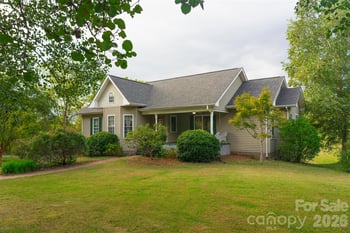
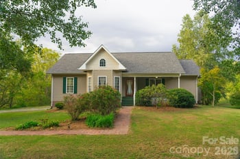
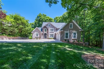
If a quieter, more rural footing within reach of the lake is what you are after, our Catawba listings are the place to start, and Sherrills Ford and Terrell cover the shoreline south of here. We are happy to talk through how these communities differ: see our buyer representation page.
Gonzalez Realty is an Equal Housing Opportunity firm. We do not discriminate on the basis of race, color, religion, sex, handicap, familial status, or national origin.
This post is for general educational purposes only and is not legal, tax, or financial advice. Real estate laws, loan programs, and market conditions change over time, and older posts may not reflect current details. Confirm specifics with your agent, a real estate attorney, a lender, or a tax professional before making a decision.
Portions of this content were drafted with AI assistance and reviewed by our team before publishing. Nothing on this page creates a client relationship with Gonzalez Realty.